


Storm Barra will hit different parts of Ireland "at different times and different strengths" on Tuesday, Met Éireann's Evelyn Cusack says.
The storm is coming in from the Atlantic overnight and is set to bring severe and damaging winds to many parts of the country tomorrow.
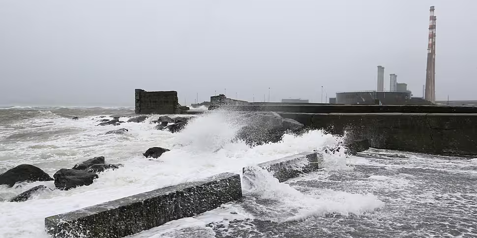
Rare status red wind warnings have been issued for Cork, Kerry and Clare, while Limerick, Waterford, Galway, Mayo, Wexford, Dublin, Louth, Wicklow and Meath will all be covered by status orange warning over the course of Tuesday.
The entire country is covered by a status yellow wind warning from 2am on Tuesday until 6pm on Wednesday.
Schools in status red and orange countries are being told to close tomorrow, while people in affected counties are being told to stay indoors wherever possible while the warnings are in effect.
On The Hard Shoulder, Evelyn Cusack - head of forecasting with Met Éireann - said different counties will see the worst impacts from the storm at different times.
She said: “The storm centre is actually moving right in over Ireland.
"It’s a complex situation to describe because the winds will all be different directions circulating around the storm centre, and affecting different areas at different times and different strengths.”
There'll be a “horrible morning” in the east, but the worst impacts will be “all over” by 11am or noon in most of those counties.
In the south and south-west, people can expect bad weather all morning and afternoon.
In Clare and parts of west Galway and west Mayo, the more severe impacts will likely be felt tomorrow evening instead.
People in the midlands and north, however, may be left “wondering what all the fuss is about” as they’re likely to experience much calmer conditions.
The storm is expected to bring some heavy rain as well, with some snow set to hit Donegal and the north-west tomorrow morning.
Evelyn observed: “Normally, our storms track to the west of Ireland… this time it’s actually crossing the country. That’s why you’re going to get easterly winds in Donegal and westerly winds in Kerry, as the eye of the storm moves in across Ireland.
“That’s why the risk of flooding is on the east coast in the morning, and on the south and west coasts in the afternoon and evening.”
'Be very, very mindful of the risk'
Micheál O’Toole, Coast Guard Operations Manager, also spoke to the show.
He said it's clear this is looking like a "significant and severe" weather event.
However, he said emergency groups have been preparing since last Friday and will respond to the situation as required.
He said: “Our message is quite simply that we’d ask mariners and people living around the coast… during this particular period of severe weather to avoid if possible exposed areas such as cliffs, seafronts etc…
"If possible, exercise additional precautions and be very, very mindful of the risk over the next 12-24 hours.”
He also noted there will likely be a “residual effect” that could continue for several days in coastal areas, such as sea swells and localised currents.


