


Storm Arwen has been named as the first weather system of the new storm season.
It will track southwards along the east coast of Scotland and England through Friday and Friday night.
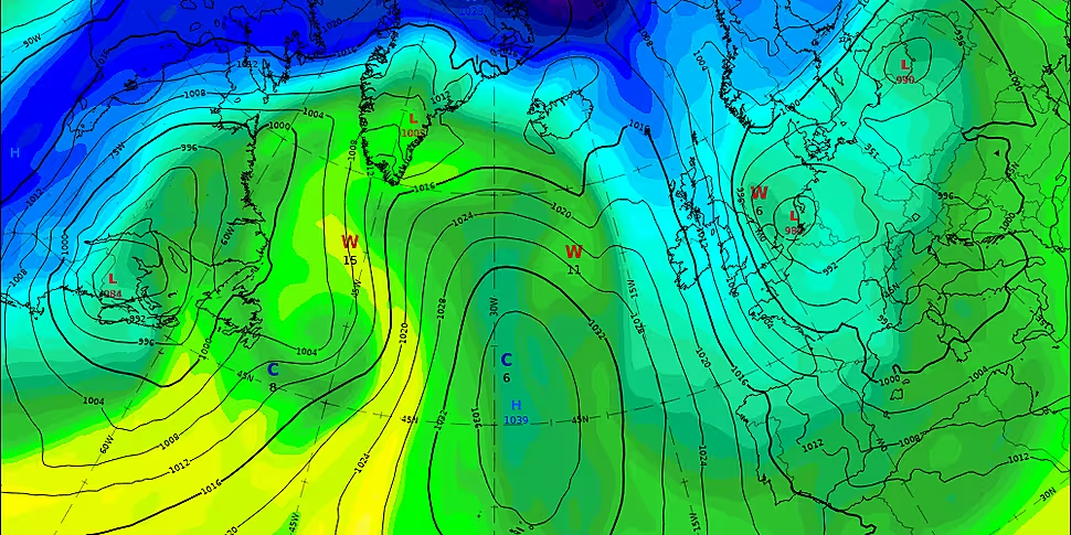
For Ireland, it will introduce strong northerly winds and a cool polar maritime air - with the strongest winds expected along northern and north-western coasts.
Met Éireann has issued status yellow wind warnings for counties Donegal, Sligo and Mayo for Friday afternoon and into Friday night.
It says northerly winds will reach mean speed of 45 to 65 km/hr, with gusts of 90 to 110 km/hr.
There could also be significantly higher gusts at times along north-facing coasts, and on the Inishowen Peninsula.
It is also warning of possible wave and spray overtopping along these coasts at times of high tide.
The British Met Office has issued wind warnings for Antrim, Armagh, Down, Fermanagh, Tyrone and Derry.
Elizabeth Coleman, forecaster at Met Éireann, told The Hard Shoulder it is going to get colder.
"Today the UK Met Office named Storm Arwen, which is going to track along the east coast of Scotland and north-east England.
"So that's where the stormiest conditions are going to be.
"But it's going to introduce strong, northerly winds across Ireland and cold, polar maritime air.
"So it's going to be a cold and very windy day tomorrow: strongest of the winds really affecting northern and north-western coasts.
"We have a yellow wind warning out for counties Donegal, Sligo and Mayo - and that's tomorrow afternoon into Friday night.
"We're going to see strong, gale-force nine winds on coasts in the north, through the day tomorrow, and they're going to transfer into the Irish Sea later on tomorrow night".
She says people should stay away from the areas on alert.
"The advice would be to stay away from the coasts during those high winds through the day tomorrow.
"We're also going to see blustery scattered showers through the day tomorrow, and turn wintery later on in the day.
"There could be some sleet showers, and then towards tomorrow night we could see some snow flurries on higher ground in the northern half of the country".
Milder, but still unsettled, conditions will return on Sunday.


