


It is set to be a wet and blustery Bank Holiday weekend with thundery showers and strong winds forecast.
While there will be some sunny spells this afternoon, Met Éireann expects heavy showers with a risk of hail and isolated thunderstorms to follow.
The rain will continue tonight, temperatures dropping to between 4 and 7 degrees.
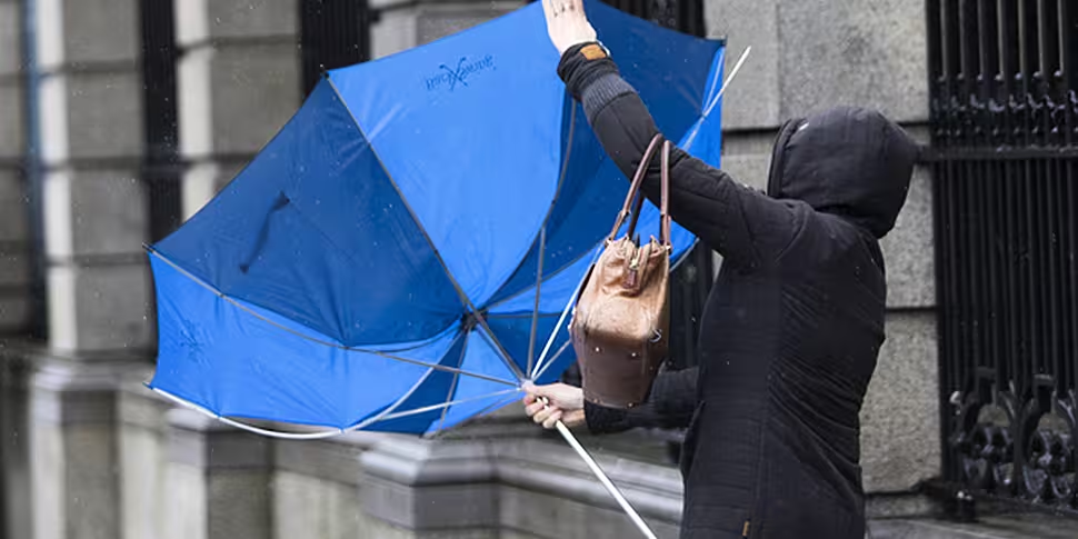
Tomorrow will be a cool and blustery day with heavy and thundery showers and a risk of hail.
Alan O'Reilly from Carlow Weather told Newstalk Breakfast with Susan Keogh that the west of the country will bear the brunt of the bad weather.
He said: "There's a low-pressure system out to the north of Ireland and the outer bands of that brought heavy rains overnight.
"That's clearing east at the moment, and there's some nice sunny spells coming in from the west.
"The problem is that there's going to be some thundery showers, so some very heavy showers and some strong winds continuing.
"Unfortunately, [there will be] more showers tonight and the west of the country will definitely see the worst of it.
He said that tomorrow will be a very windy day as well, and more showers, mainly in the west.
Mr O'Reilly said: "The east coast of the country will certainly enjoy the best of the weather.
"The best part of the weekend for the Bank Holiday weekend looks like being Monday.
"There will still be a few showers but a respite in the winds or an ease off on Monday before possibly we start to see some more stormy weather again."
Looking towards the rest of the week, he said the conditions remain very uncertain due to a hurricane in the Atlantic.
Mr O'Reilly said: "There's a hurricane, Hurricane Epsilon, in the Atlantic at the moment and it's starting to take a turn in our direction.
The last of summer time sunrises this morning as the satellite images show blue skies in the West with cloud in the East. Clocks go back tonight so sunrise was 08:10 this morning but it will be 07:12 tomorrow. Sunset is 18:12 today but 17:10 tomorrow. pic.twitter.com/UnYwneyDDN
— Carlow Weather (@CarlowWeather) October 24, 2020
"It looks like it's going to turn towards Iceland and become a tropical storm, so it will lose its hurricane status probably tomorrow night.
"However, it's going to link up with another storm coming out of the Greenland direction.
"The weather models are very uncertain depending on where that's going to track but unfortunately, it does look like it's going to have some impact, especially for the west coast, with some very high seas and a risk of strong winds again.
"That will mainly be Tuesday into Wednesday so that's something to keep an eye on, and it does look like we will see another low-pressure system possibly coming for Thursday as well."
He added: "Unfortunately it's going to be very unsettled weather so it's going to be a matter of looking for a break in the rain.
"Obviously, with the clocks going back there's a change as well so people will need to pick an hour in between the showers and watch those strong winds."


