


While the worst of Storm Chandra may have passed, heavy spells of rain are forecast for most of the country over the Bank Holiday.
Throughout the previous week there have been reports of consistent and damaging flooding across towns in the east coast which impacted both commuters and businesses.
Despite the Yellow warning no longer in effect, Ireland's Weather Channel Cathal Nolan told The Anton Savage Show that Ireland needed to see the rollout of a hydrological forecasting team.
“The whole area concerning what happens when the floods actually occur seems to be an issue,” he said.
“As we move forward, we are going to continue to see more flooding issues. That's as a consequence of a higher population in the east, southeast of the country and the fact that we've built on these existing floodplains.
“We’re building closer to areas that traditionally would have flooded and we need to get the communication part right for future scenarios.”
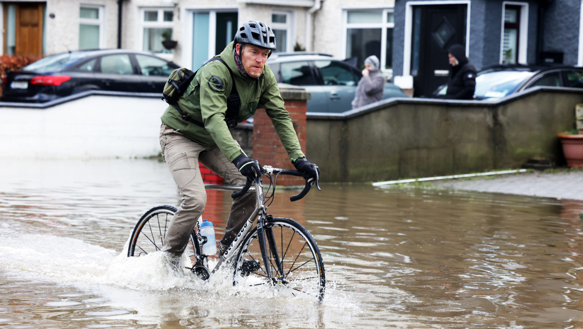 A man cycling through floods on Nutgrove Avenue. Photograph by: Leah Farrell.
Mr Nolan added that floods were going to continue to happen regardless but Ireland wasn’t putting its best foot forward when they did.
“When it comes to the two topics around climate change adaptation we’ve put most of our energy so far into the mitigation side of things,” he told Emmet Oliver.
“We really need to start focusing on the adaptation as well. When preparing for storms like this we need to make sure we have the infrastructure in place so that when they occur we can see a better response to these events,” he added.
Mr Nolan cited the catastrophic fallout from last year’s Storm Eowyn as proof that extreme meteorological events seem to be happening more frequently and new strategies needing to be put in place.
"As a country, we need to take a broader look at the impacts we’re likely to see, identify the areas most prone to these risks and then we can forecast these events in many cases.
“A week to three days in advance which should give you sufficient time to get the proper equipment into these locations so that when it occurs, you’re prepared for it.”
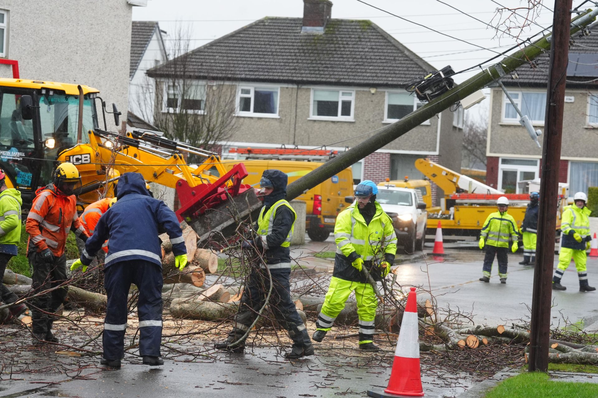 Workers clearing a fallen tree on Grove Park Drive in Dublin. Picture by: PA Images / Alamy.
Asked how Ireland compares to its counterparts in terms of its flood management system, he said the country is still a long way away from countries like the UK who have a separate agency constantly monitoring rivers.
“In the UK they can forecast right down to each river scenario - that’s what we need to get to,” he said.
Mr Nolan confirmed he is partial to leaving the county-by-county system.
“The weather you see in Bantry won’t be the weather you see in Youghal and we’ve seen that in different scenarios when it comes to wind speeds.
“West Cork could be up around 130 to 140 kilometres per hour, which requires the Status Red warning, whereas parts of East Cork, parts of North Cork and Mallow could be only seeing winds 80 kilometres per hour, which is Status yellow.”
He told Emmet Oliver the range needed to be reduced so analysis could be carried out on a local basis and warnings shared in due course.
Main Image: Submerged traffic sign.


