


Up to 40,000 people could lose power this weekend with the arrival of Storm Jorge.
It is due to bring strong winds and some rain - raising fears of flooding in parts.
It has already been one of the wettest Februarys on record, and more rain is forecast for tonight.
Storm Jorge, as named by Spain, will impact Ireland on Saturday.
There will be heavy thundery downpours of rain and hail, and snow in places for a time in the morning.
A stormy day with very strong westerly winds and damaging gusts - as well as some further flooding - is forecast.
Met Éireann has issued an orange wind warning for Clare, Galway Kerry and Mayo from 6.00am on Saturday to 3.00am Sunday.
A warning will also be in place for Donegal, Leitrim and Sligo from 12.00pm Saturday to 3.00am Sunday.
The National Emergency Co-Ordination Group has met this afternoon ahead of the storm's arrival.
The group is made up of State bodies including Gardaí, the Defence Forces, the Coast Guard and Met Éireann.
Officials are now advising people to stay away from coastal areas, to check in with vulnerable neighbours and to take care on the roads.
A meeting of the National Emergency Co-Ordination Group is underway.
A number of state agencies are discussing how to prepare for Storm Jorge this weekend pic.twitter.com/hYm691THKp— Stephen Murphy (@StephenMNews) February 28, 2020
Fergus Griffin from the Defence Forces said there are plans in place to help people in areas at risk of flooding.
He said: "Since the 24th February, the Defence Forces has deployed 209 personnel in the preparation and maintenance of flood defences.
"We currently have 29 personnel deployed in the Castleconnel area of Limerick, and we stand ready to assist our colleagues in the local authority."
Planning Minister Eoghan Murphy, meanwhile, warned that weather conditions will worsen over the weekend.
He said: "Damaging gusts are possible anywhere - this means that trees could come down anywhere.
"Met Éireann will be updating and possibly escalating their warnings later on this afternoon."
Minister Murphy said while the flooding risk will continue, there is also a risk of power outages over the weekend.
Weather warnings
A yellow weather warning is also in place for Leinster, Cavan, Monaghan, Roscommon, Cork, Limerick, Tipperary and Waterford from 9.00am on Saturday until 3.00am on Sunday.
There is a further yellow weather warning in place for Munster, Connacht and Donegal for all day Friday and Saturday.
Storms Ciara and Dennis have already brought heavy rain and some flooding to parts of the country this month.
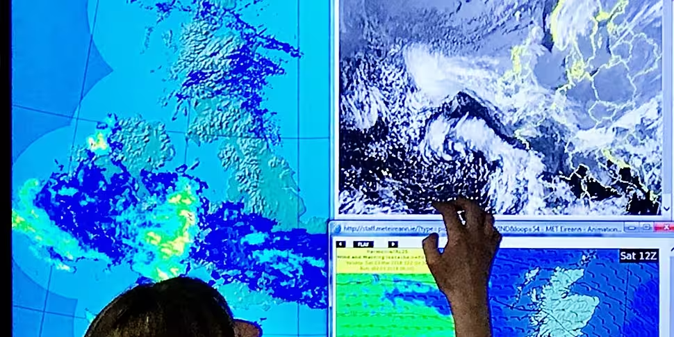
Forecaster Elizabeth Coleman earlier explained what people can expect.
She said: "We do expect gusts of up to 130 km/h along Atlantic coasts, but possibly even higher in coastal areas.
"So we will be updating our warnings through the day today".
Mostly cloudy today with rain, heavy in places, compounding the current flooding situation. Milder than recent days with highs ranging 7 to 11C generally, but remaining cold in Ulster until later in the evening. Fresh to strong & gusty SE winds will veer SW through the day. pic.twitter.com/se8SDQdgU7
— Met Éireann (@MetEireann) February 28, 2020
Brian Farrell from the Road Safety Authority (RSA) says drivers need to take extra care.
"What we're saying is that you do really need to be on guard for these conditions.
"It means slowing down, it means expecting the unexpected when you go round the next corner - particularly on local roads".
The RSA is asking road users to exercise caution while using the roads over the next few days.
Road users in areas affected are advised to check local traffic and weather conditions before setting out on a journey.
The following advice is being given to motorists:
- Control of a vehicle may be affected by strong cross winds. High sided vehicles and motorcyclists are particularly vulnerable to strong winds.
- Beware of objects being blown onto the road. Expect road conditions to change quickly in high winds so reduce your speed
- Watch out for falling/fallen debris on the road and vehicles veering across the road
- Drivers should allow extra space between themselves and vulnerable road users, such as cyclists and motorcyclists as they may be blown off course by strong winds
- Drivers need to slow down in wet weather conditions, especially on high speed roads such as dual carriageways and motorways where there is increased danger of aquaplaning
- If the road ahead is flooded choose another route, do not attempt to drive through it
- Road users should always follow recommended routes and obey signs closing roads to traffic
- After going through water, drive slowly with your foot on the brake pedal for a short distance - this helps to dry the brakes
- Drive with dipped headlights at all times
Advice to pedestrians, cyclists and motorcyclists:
- Visibility and light is reduced in poor weather conditions. Keep safe by making sure you can be seen. Wear bright clothing with reflective armbands or a reflective belt
- Take extra care when crossing the road or cycling in extremely windy conditions as a sudden gust of wind could blow you into the path of an oncoming vehicle
- Walk on a footpath, where possible and not in the street
- If there is a footpath and it is safe to use, look out for falling debris from above, especially in urban areas
- Walk on the right-hand side of the road, facing traffic if there are no footpaths
- Cyclists should ensure that they and their bike are visible to other road users by investing in a good set of front and rear lights (white at the front, red at the back) and by wearing clothes that help you be seen on your bike such as bright and light reflective items
For many communities, especially those along the Shannon already hit by flooding, it will be an anxious wait to see what conditions the storm brings.
Additional reporting: Stephen Murphy


