


Met Éireann says it is closely monitoring the progress of Hurricane Lorenzo.
Forecasters say it looks like Thursday could be a 'danger period' for Ireland as the storm moves across the North Atlantic, but added it will have a better idea of the hurricane's path in the next 24 hours.
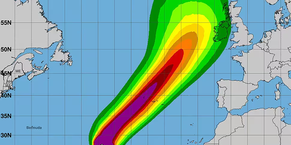
A hurricane watch is in effect for parts of the the Azores as the category storm 3 continues across the ocean, with maximum sustained winds of 175 km/h.
The US National Hurricane Centre is warning of large wells across much of the north Atlantic basin over the coming days.
Here are the 11 pm AST Key Messages for Hurricane #Lorenzo pic.twitter.com/BGyDltfgJh
— National Hurricane Center (@NHC_Atlantic) September 30, 2019
Lorenzo is expected to recede to a tropical storm by the time it reaches the vicinity of Ireland.
However, Met Éireann's Deirdre Lowe says Lorenzo could bring stormy conditions even if it doesn't make landfall.
Speaking on Newstalk Breakfast, she explained: "It could be a problem for Ireland on Thursday alright.
"It's predicted to track to the west of Ireland, so it's not predicted to make landfall - but it still brings the risk of severe winds, possibly stormy conditions and very high seas.
"That track may change, so we are keeping a close eye on it."
She added that if the storm continues on its current path it would likely impact Ireland for a 'day or two'.
Met Éireann, the UK Met Office and the US National Hurricane Centre (NOAA) are holding daily discussions to monitor the progress of the storm.


