


Hundreds of homes, farms and businesses remain without power after strong winds and some snow overnight.
The ESB says the main outages recorded today were in Enniscrone, Co Sligo and the Cooley Peninsula area in Co Louth.
The electricity supplier has apologised for the inconvenience and says crews are working to restore the supply as quickly as possible.
A number of weather warnings have been issued for counties nationwide this weekend.
Here is the latest rain & cloud forecast from our HARMONIE weather model. It covers the period from now until midday on Monday.
Detailed forecasts and warnings here ➡️: https://t.co/YJqxvBBwTs pic.twitter.com/j0VaHIO03X— Met Éireann (@MetEireann) February 13, 2021
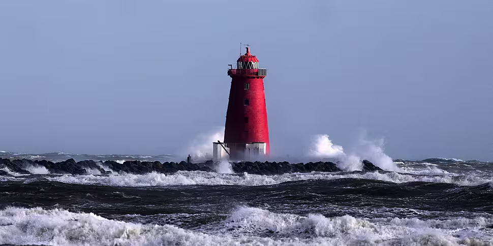
Met Éireann issued a Status Orange wind warning this afternoon for Donegal, Galway and Mayo.
The advisory is in place from 12pm until 4pm tomorrow.
Winds will reach mean speeds of up to 80km/h with severe gusts in excess of 110km/h in the west, while where winds are onshore, there is a risk of coastal flooding.
A Status Yellow wind warning for Dublin, Louth, Wexford, Wicklow, Meath, Donegal, Galway, Leitrim, Mayo, Sligo, Clare, Cork, Kerry, Limerick and Waterford will also be in place tomorrow.
This will be in effect from 5am until 5pm on Sunday, with wind speeds of up to 65km/h and gusts of 90 to 110km/h forecast.
There is also a wind warning in place for Carlow, Kildare, Kilkenny, Laois, Longford, Offaly, Westmeath, Cavan, Monaghan, Roscommon and Tipperary.
From 6am until 4pm on Sunday, Met Éireann is warning of winds reaching speeds of up to 60km/h and gusts of 90km/h.
Forecast
However, Alan O'Reilly from Carlow Weather says it is likely the worst of the conditions have passed.
He told Newstalk: "For those looking for the snow, many might have seen it fall for a time but then see it turn from sleet and then to rain.
"But in some areas, especially in the northeast and on higher ground in Wicklow, it may well have continued to be snow and there may be some accumulations of snow, and it is possible is some higher ground parts of the east in general.
"But for many, it will have turned to rain and the thaw will slowly set in.
Mr O'Reilly added that snow showers will persist in places, before milder conditions return next week.
He said: "It's going to be turning much less cold, slowly though, and it will continue to be very windy though.
"Also continuing is some falls of sleet and snow and rain, the heaviest rain will be in the south of the country but clearing east then through [Saturday] with some dry spells for at least a while."
This article was originally published at 9.29am


