


The State's Crisis Management Team is asking people in areas affected by Storm Betty to stay safe and be prepared.
Weather alerts have been issued for the entire country as the storm batters Ireland.
Yellow and Orange warnings for rain and wind, as well as a Red marine warning off the south coast, are in place.
The National Directorate for Fire and Emergency Management (NDFEM) said it has been liaising with Met Éireann.
A briefing was held on Friday with all local authority severe weather assessment teams, Government departments and agencies to prepare for the arrival of Storm Betty.
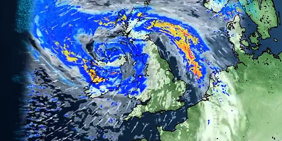
Current forecasts indicate the storm will move across the country during Friday afternoon into Saturday morning, moving southwest to northeast.
It will potentially bring strong winds, rain and the threat of coastal flooding.
Storm Betty is forecast to bring high winds, particularly across southern areas, with rainfall levels of 40mm across the country.
There is potential for over 60mm of rain in some areas.
A number of key public safety and information messages have been issued by the NDFEM.
In areas affected it is likely there will be:
- High seas: The public is advised to stay away from coastal areas during this period
- Very strong winds: These will make driving conditions hazardous, especially for the more vulnerable road users, e.g. cyclists, pedestrians, motorcyclists and high-sided vehicles
- Road users should pay particular attention to the risk posed by fallen trees and flying debris as trees are in full leaf
- Potential for tidal flooding in coastal areas: Especially in southern and eastern counties
- The storm may also bring localised heavy showers, which in turn may lead to surface flooding in urban locations
"People should be extra vigilant and aware of the risk potentially posed by trees in high wind events," the NDFEM has said.
"The most widespread and potentially dangerous consequence of high wind is the risk of trees breaking/falling, possibly bringing down live power lines, posing a danger to motorists and pedestrians in the vicinity.
"People are advised to prepare for the arrival of the storm, including ensuring their mobile phone is fully charged to enable communication.
"The public are again reminded to monitor Met Éireann forecasts for their area and to be aware of the changing weather conditions and to heed safety warnings," it added.
⚠️ Status Orange Rain Warning Updated ⚠
Location: Carlow, Kilkenny, Wexford, Wicklow, Cork, Kerry, Tipperary, Waterford.
Potential Impacts:
• Localised flooding. ☔
• Difficult travelling conditions. 🚗 🚴♀️ 🚶♂️
• Wave overtopping on coasts. 🌊https://t.co/Xg3aMJlyuS pic.twitter.com/iDtrvPVMWE— Met Éireann (@MetEireann) August 18, 2023
The Irish Coast Guard is strongly advising people who are planning any water-based or coastal activities to check the weather carefully and consider if the conditions are suitable.
"Strong winds can result in relatively rough seas resulting in perilous sea conditions which could be challenging for water-based actives this weekend," the Coast Guard said
"The general advice from the Coast Guard in stormy conditions is to stay back from cliffs and exposed coastal areas and piers where breaking waves can be hazardous," it added.
Anyone who notices someone in difficulty is advised to call 999 or 112 and request the Coast Guard.


